
Road Trip Navigation: Paper Maps, GPS Devices, and Smartphone Apps Compared
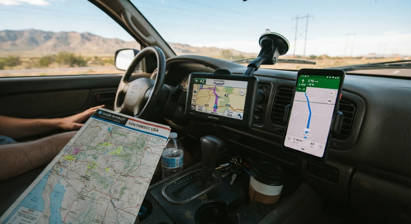
Photo credit: SnippetColumns.com | Easy Search, Reliable Information
In this article
A practical look at offline maps, dedicated GPS units, and phone navigation apps — what each does well and where each can let you down.
Key Takeaways
- Paper maps never lose signal and cost nothing after purchase, but offer no real-time updates.
- Dedicated GPS units provide reliable offline navigation and windshield-ready form factor without draining your phone battery.
- Smartphone apps deliver live traffic and free map updates but depend on data connectivity and device charge.
- A layered approach — combining two methods — is the most reliable strategy for long-distance driving.
Why Navigation Choice Still Matters
Most drivers grab whatever navigation tool is already in their pocket, but that casual approach can backfire the moment a rural stretch drops cell service or a phone battery dies in the July heat. Before your next long drive, it's worth understanding what each option actually delivers — and where each falls short. For a broader look at preparation, see our complete road trip planning framework covering everything from route selection to safety.
The three main tools — paper maps, dedicated GPS units, and smartphone navigation apps — each solve the same core problem in fundamentally different ways. Understanding those differences lets you pack strategically rather than hope for the best.
| Paper Map | GPS Device | Smartphone App | |
|---|---|---|---|
| Works without cell signal | Yes — always | Yes — onboard maps | Only with offline download |
| Real-time traffic updates | No | Limited (with data plan) | Yes — when connected |
| Battery dependency | None | Dedicated battery/car power | High — drains phone fast |
| Map update frequency | Manual purchase required | Periodic downloads | Automatic via app updates |
| Upfront cost | Low ($5–$15) | Medium-high ($100–$300+) | Often free |
| Ease of use while driving | Requires stopping safely | Designed for in-car use | Good with mount; risky hand-held |
| Best for remote areas | Excellent | Very good | Depends on offline prep |
Paper Maps: Low Tech, High Reliability
A folded road atlas or state map costs a few dollars, never loses satellite lock, and works in a dead zone, a power outage, or a flooded parking lot. Paper gives you the big picture at a glance — something scrolling a phone screen can't replicate — and it forces better route awareness before departure.
The downsides are real: paper maps don't reroute around accidents, can't display real-time traffic, and require a driver to safely pull over before consulting them. Map editions also go stale; new interchanges, toll road changes, or road closures won't appear until you buy an updated edition. For most drivers, paper is best used as a backup that lives in the glove box rather than the primary guide.
Download Offline Maps Before You Go
Most major navigation apps allow you to download regional or state-level maps for use without a data connection. Do this at home over Wi-Fi at least the night before departure. Offline maps won't provide live traffic alerts, but they will keep you on course through dead zones — which is often all you need.
If your route crosses remote terrain or national forests, a topographic map or state-specific atlas adds detail that digital tools sometimes omit entirely.
Dedicated GPS Devices: The Middle Ground
A standalone GPS unit mounts to the windshield, speaks turn-by-turn directions, and doesn't compete with calls, texts, or music apps for screen space. Crucially, most store detailed maps onboard — meaning they work without any cellular signal. That's a meaningful advantage on mountain passes, rural highways, and areas where coverage is thin.
Map updates on dedicated units require occasional downloads (usually via Wi-Fi or a computer), and some manufacturers charge for major map refreshes after a set period. The hardware cost is higher upfront than a free app, and the form factor adds one more device to manage and charge. That said, a GPS unit won't drain your phone battery, and it holds its own in direct sunlight where many phone screens wash out.
~20%
U.S. geography with limited cell coverage
The FCC has reported that a significant portion of U.S. land area, particularly rural and tribal regions, lacks reliable broadband or mobile coverage.
3–5 hrs
Typical phone battery life running GPS navigation
Consumer electronics testing generally shows active GPS navigation with screen on depletes most smartphone batteries within three to five hours of continuous use.
For drivers planning routes that mix interstates with back roads — a scenario covered well in our scenic routes vs. interstates comparison — a GPS device's offline capability is a genuine asset.
Smartphone Apps: Powerful but Dependent
Navigation apps available on iOS and Android offer live traffic data, incident alerts, updated points of interest, and rerouting that responds to conditions as they change. For most urban and suburban driving, they're unmatched in utility and convenience — and many carry no ongoing cost beyond the device you already own.
The vulnerabilities stack up on a long road trip. Heavy GPS use drains a phone battery in a few hours without a car charger. Cellular dead zones — common across wide stretches of the American West and rural South — cut off live rerouting. Some apps offer downloadable offline maps that work without a signal; using that feature before departure closes much of the reliability gap.
Distraction risk is also worth naming. A phone mounted on the dash is safer than hand-held, but the same device that navigates also buzzes with notifications. Keeping the screen locked to navigation during driving is a practical habit worth forming. Navigation errors and over-scheduled itineraries frequently land on lists of planning mistakes that derail road trips — choosing the right tool for your route is part of the planning process, not an afterthought.
Building a Reliable Navigation Setup
The most practical approach for a long road trip isn't picking one tool — it's layering two. A smartphone app as the primary guide, paired with a paper atlas or a dedicated GPS device as a backup, covers the scenarios where either tool fails alone. Download offline maps for your entire route before leaving home; this alone resolves the majority of connectivity problems.
Keep a car charger capable of powering your phone while running navigation, and consider a small power bank as an additional buffer. If you're traveling with passengers, designating a co-pilot to handle map consultation while the driver focuses on the road reduces distraction risk meaningfully.
Navigation is one piece of a larger trip budget; gear costs and data usage are worth factoring in. Our road trip cost breakdown outlines where spending tends to surprise drivers. And if your route includes overnight stops, the overnight lodging comparison covers campground, motel, and rest stop trade-offs worth reviewing before you book.

Author
Autos & Driving Editorial Team
Autos & Driving Editorial Team is the collective byline for our editorial team and contributor network. Articles published under this byline or an editorial pen name are researched, written, and reviewed according to our editorial standards for clarity, consistency, and independence before publication.
View all articles →